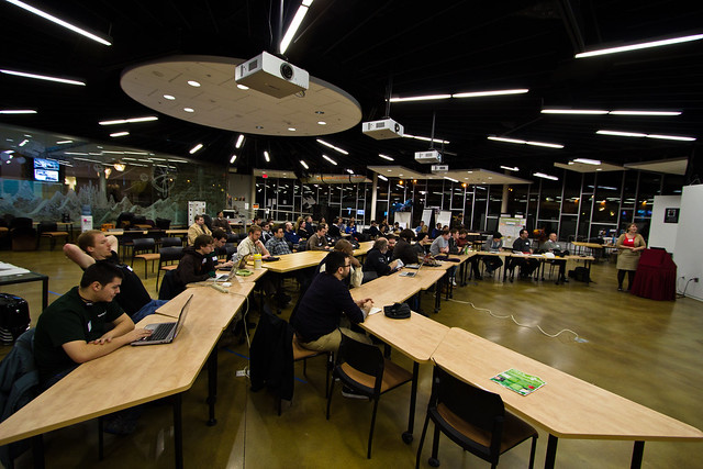
A few Wednesdays ago, after a long and cozy day of working from home, I decided to break my "never leave the house or have meaningful human contact" rule, and I ventured out to the snowy tundra of Henrietta. The threshold for this odd behavior is quite high, but I just couldn't bring myself to miss the first meeting of Hacks/Hackers Rochester, a local group aiming to mush together journalists, programmers, technologists, designers, and what-have-you, just to see what kind of nutty/useful stuff results.
Before I get too far, I'll have you know that their next meeting is Wednesday, February 15th (at RIT's Center for Student Innovation), and you can get at them on their meetup group, or their twittery bits. If combining technology and journalism sounds fun to you, you should stop by, because it seemed like a bunch of smart and interesting people.
Ok. For the rest of our time together, I'm fixin' to dump a few links on you. I am not a journalist, nor a programmer, but I have been quite interested in this area for some time, and hope to contribute – at the very least – as a well-informed cheerleader, brainstormer, facilitator, or village idiot. We'll see. Either way, maybe I can give interested parties some ideas of what's possible/probable before the next meeting.
Open Sesame
"Open" excites me. Open source software, open hardware designs, open data, "free culture" in general. Fun things happen when information is free and accessible. Maybe this first dawned on me when I saw the Oakland Crimespotting site. By now, everybody has seen a multitude of visualizations made by dumping data on top of Google Maps. Back then it was pretty new and exciting. What struck me most, at the time, was that the Oakland PD was publishing this data to a public website, and in a format that was fairly easily scrape-able and parse-able. Wow! Amazingly pedestrian, really, but for a city or county government it seemed unthinkable (and still does, apparently).
Many municipalities are doing a decent job in this area nowadays. Some have even progressed enough that sites like EveryBlock have sprung up, taking these public data feeds and massaging them into a format that mere mortals can make sense of. Baltimore has an open data website that looks like it has lots of useful info, in easy to digest formats. Chicago too. I'm sure there are many others... those were just the first two to pop up when I poked around for "data dot blah blah dot gov" sites. There is no data.cityofrochester.gov site, unfortunately. How do we make that happen?
Dumpy Data
In the meantime, we rely on FOIA requests for information from local governments. Often times, these arrive in the least convenient format possible, and they are likely full of sloppy and inconsistent data. We're pretty lucky then, that after cleaning things up, the D&C often shares this data with us on their RocDocs site.
I wonder if they know about Google Refine? Refine is "a power tool for working with messy data, cleaning it up, transforming it from one format into another, extending it with web services, and linking it to databases like Freebase." If you're dealing with cruddy data of any sort, you should check it out. It's a bit of a weird install, running as a web server on your computer. Ask your local nerds if you're having trouble... it's worth it.
Community Data
Even if you can get it in a decent format, governments don't always have the data you need. Or if they do, it might be stale by the time you can get at it. There are some fun things happening in the world of open data acquisition. Let's call it "open mapping", although I'm sure there are non-location-based projects I'm overlooking.
First, Google is changing the terms of service on their Maps product... taking it out of "beta" status and reaching into your wallet for some payback. If you have a certain amount of map views per day, it's no longer free to use. Thankfully, all along, a large community of folks have been creating their own street maps by compiling open government data (TIGER files in the US), or by walking, biking, and driving routes with a GPS logger and uploading their tracks. OpenStreetMap is the result, and it's an amazing feat. Anybody can edit the map... so feel free to liken it to the "Wikipedia of maps", even though that probably makes some people bristle. Not coincidentally, the resultant data is available under a farily open license, and has thus been mixed and remixed into a plenitude of other projects, products, and experiments.
OpenCycleMap builds upon OpenStreetMap, and highlights cycling routes. It is rather sparse in the US. I recently attended some public meetings on Rochester's bicycle plan, featuring some large maps of city streets rated "A" through "F" for bike safety. Perhaps that belongs on such a map, editable by all those who actually ride the city streets and know that traffic volume and speed are not the only relevant dimensions for such a grade.

OpenHeatMap lets you upload a spreadsheet of data and crank out a heat map on top of OpenStreetMap. Mapbox is a bit more sophisticated, but costs some money for hosted maps. No matter... the Mapbox developers have released TileMill, a gorgeous application that lets you handcraft interactive maps yourself. It requires a bit more knowhow, but I'm sure Hacks/Hackers has plenty of that.
The folks at Safecast wanted to map radiation levels following the Fukushima disaster in Japan, so they cobbled together some GPS loggers and Geiger counters. After driving around the country, they plopped the data on top of the OpenStreetMap. This isn't child's play yet, but every day it's getting easier to bring together the hardware and software needed to record data and make it easily available.
A Brief Aside
These radiation mappers weren't "traditional journalists". Maybe it wasn't even journalism or news. Whatever. It was really important info, and I'll bet no reporter thought "I'll just go out and record that data, instead of waiting by the phone for an official report". I hope, after hanging out at Hacks/Hackers, that mindset will change.
Semi-related: Rochester has a nuclear power plant nearby, and Interlock has a Geiger counter:
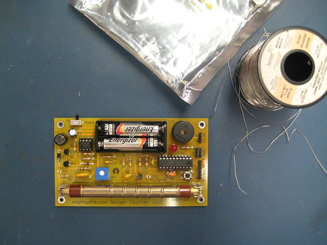
(not a terribly well calibrated Geiger counter, admittedly)
For some more thoughts on the future of local news and journalism, from people much smarter and more cogent than I, I will simply link without comment to some posts I've bookmarked from Ryan Sholin, Jeff Croft, and Tim Porter.
Burbling Infobrooks
If real-time info is needed, Pachube is a free clearinghouse for data feeds. It's ridiculously easy to upload sensor data to the site, whether it be temperature, weather, energy use, and so on. Equally important, it's also easy to retrieve that information as a regularly updated and well-documented stream. Would you like to browse the 2700 available feeds tagged "radiation" on Pachube? Probably not. But it'd be a relatively simple task to create a program that retrieves and maps them in an easy to digest format.
Some folks – mainly in New York City – weren't quite satisfied with the current status quo of air quality monitoring. So they're building their own sensor network using open platforms to measure and make the data available to anybody that wants it, in real time. This stuff isn't too technically challenging nowadays. We just need to pair up those with a need for info with the people who know how to get this stuff done.
Too Long; Still Reading
There's plenty more fun stuff happening in this area, but that's enough to keep you occupied for a few hours a least. If – after you close all your browser tabs – you still find your cravings unfulfilled, do join us at the next meeting, or fire away in the comments here. I'm sure we'll be able to fill up or otherwise utilize your vast cranial resources. See you there!